Platforms, not just maps
A Web GIS earns its keep when it runs an operation: asset registers with live status, project progress by layer, field teams syncing from Android apps, alerts when a device goes offline. Our in-house GeoTrack platform — Node.js and PostGIS with JWT authentication and role-based access — was built around live project survey data, and that DNA goes into every client system.
From your data or ours
We integrate the datasets we capture (drone, LiDAR, DGPS, field surveys) or yours — legacy shapefiles, CAD drawings, spreadsheets — into a governed PostGIS database with clean schemas, then expose exactly the views each role needs: executive dashboards, engineer tools, public portals.
Engineering discipline
Version-controlled code, documented APIs, deployment on your servers or cloud, and handover documentation. Open-source stack end-to-end (PostGIS, GeoServer, Leaflet/OpenLayers, Python/Node.js) keeps you free of licence traps.
Deliverables you receive
- Web GIS portal with role-based access (JWT)
- PostGIS spatial database with documented schema
- Android field data collection app with sync
- Dashboards: KPIs, layer analytics, reports/exports
- REST APIs for integration with existing MIS
- Source code, deployment & admin documentation
Specifications & standards
| Parameter | What we deliver |
|---|---|
| Backend | Node.js / Python · PostGIS |
| Frontend | Leaflet/OpenLayers dashboards |
| Mobile | Android field apps, offline-capable |
| Auth | JWT, role-based access control |
| Hosting | Your server / cloud; we deploy |
| Handover | Code + docs — fully yours |
Recent work
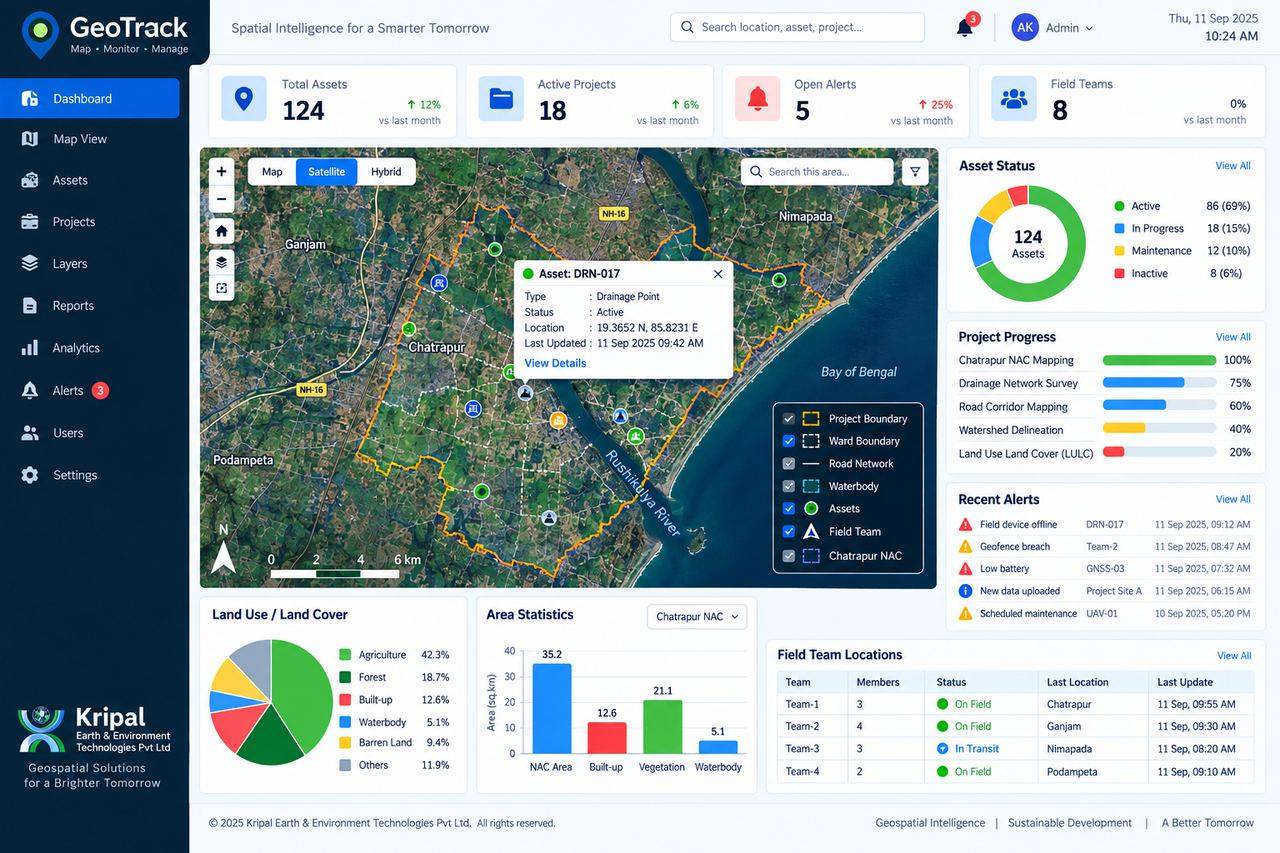 GeoTrack — Web GIS / MIS Platform
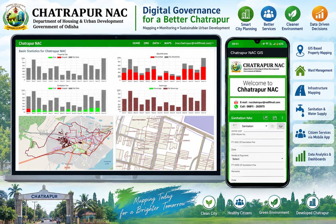 Chatrapur NAC GIS-MIS
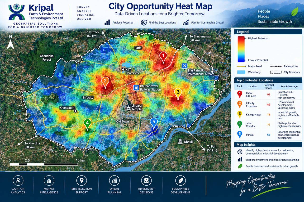 Location Intelligence Analysis